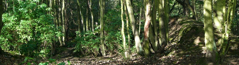
The broad shape of Flass Vale was laid down when ice age glaciers melted leaving sand, clay and gravel behind as water flooded towards the valley of what is now the river Wear. The Wear valley was gradually colonised by vegetation and eventually developed into woodland. About 3,000 years ago people settled and gradually cleared much of this forest for pasture. Maiden’s Bower in Flass Vale is a burial mound dating from this time.
Owing to the high rainfall and acid sandy soil the dominant vegetation developed as moorland with mixed heather and acid grassland plant communities. In medieval times the Vale was incorporated into Crossgate Moor and Framwellgate Moor parishes – and presumably most of Flass Vale was rough grazing land (a fragment of heather moor was present until the 1980’s) with marshy ground in the valley bottom (‘Flass’ is a Scandinavian word meaning marsh). Maiden’s Bower lies below the plateau of ground where the Battle of Neville’s Cross was fought in 1346. The valley is drained by Flass burn – originally known as Mill burn which drove a corn mill before entering the river Wear. Not much is known about land use – but one area – Gibbet Knowle was probably used to display bodies of people who had been hung in nearby Gallows field.
In the 18th century new methods of deep ploughing broke up the moorland soils and following Inclosure (Crossgate 1770; Framwellgate 1802) the grasslands were improved. Fields were pasture or arable with patches of planted trees and well defined boundaries – some with hedges. By this time the Vale was owned or leased by local families e.g.- Bulmer, Nelson, Castle, Richardson, White, Robson, Mallam, Atkinson, Addison, Kidson and Byerley.
By the time the first detailed OS maps of Durham were published in 1858/9 there was a large orchard surrounding the Rose Tree Inn with pathways leading from it into Shaw Wood Gardens. A path on the other side of the valley led through the orchard to a small enclosure.
40 years later the orchard is greatly reduced and replaced by Flass House and several small holdings. The pathways from the Rose Tree into the Vale are simplified and substantial buildings are marked on the corner of ‘Rose Tree Lane’ and back Western Hill . The path from Flass House leads to a cottage, which was demolished in the 1940’s. By this time a Curling pond had been established at the top of the Vale by building a dam with a sluice which held back the water from the burn in winter. Several curling stones exist which were thrown out from Flass House when it was vacated by the Red Cross in 1990. Flass farm was rebuilt in 1990’s. The area of woodland marked on the map stays much the same.
By the end of the first world war, in 1919, the old Shaw Wood gardens are shown as allotments and two sand pits are marked. The path to the cottage is reduced. At the top end of the Vale there is a sewage works. A large house -the Larches at the end of a path leading from Fieldhouse Lane and Fieldhouse Terrace has been built.
Between the wars the Bus Garage (Omnibus Depot) was built next to the Rose Tree and the orchard has almost disappeared. Flass Bungalow was built and the neighbouring sand pit was extended as Flass Quarry with buildings assumed to become the offices of Newtons scrap yard. Friarside is marked on this map. The sewage works at the top of the Vale appears to have been abandoned – later the area was used as an allotment and in 2009 it was planted as a wild flower glade.
Grazing continued and the Vale is shown in photographs in Sharp’s plan of Durham (1942) as rural pasture land. A few animals grazed in the Vale up until the 1960’s. At some stage the cottage was demolished and a large area was tipped with building rubble. After the second world war much of the land on the edge of the Vale was developed for housing. In 1973 local people fought the ‘Save Flass Vale’ campaign which prevented some development and led to the acquisition of land by the local Council. The wildlife value of Flass Vale was recognized by its designation as a Local Wildlife Site in 1982. The western section is registered Common Land while the part owned by the Council was designated as a Local Nature reserve in 2008. Most recently the Bus Depot and the southwest portion of the Vale have been developed as housing and some student accomodation.
The Friends of Flass Vale community group was established in 2002 and volunteers work regularly to manage the area to enhance biodiversity of woodland grassland and marsh habitats – and maintain and improve access for visitors.